Thursday 10 March 2016

Extension of E4 long distance footpath to link up with Via Algarviana

My 32 day walk showed that you can extend the European E4 long distance walk so that you start at Cabo Sao Vicente in Portugal, in the south west corner of Europe, rather than Tarifa in Spain. This adds 755 kilometres (472 miles) but truly makes this a walk from one extremity of Europe to the other. The walk falls in four parts, details of each part can be found under the links below, and blogs of each day, with distances walked and where I stayed, appear in the preceding daily posts. The route I used does offer a great diversity of scenery, accommodation that does not rely on wild camping and takes you through a number of historic towns, but certainly there are options to improve on it.

Via Algarviana

Alcoutim to Seville

Camino de Santiago route from Seville to Puerto Real

Coastal route from Puerto Real to Tarifa

If you enjoyed this blog, then see how I got on later in my journey on the E4 at the following links:

Report of walk to date on E4

Blog of my walk on the E4 through Hungary, Serbia, Bulgaria, Greece and Cyprus.

Update: Based on my travels on the E4 I have written a book "Six Pairs of Boots: Spain to Cyprus on the E4 Trail" by John Pucknell available from Amazon.co.ukAmazon.com, the Bookdepository.comlehmanns.debookspot.nl, and other good online bookstores.


Sunday 6 March 2016

Puerto Real to Tarifa walk

This last section was a beautiful coastal walk along beaches, passed small towns and through natural areas of pine trees and juniper. Unlike many coastal routes it did not require repeated climbing up and down the side of valleys, and the coast is fairly straight so the walk is not extended by walking around indented bays and peninsulas. Parts of the beaches had soft sand that made for slow progress but there was usually some harder sand to walk on so I was not slowed down too much. There was enough accommodation (including campsites), cafes, restaurants and shops to avoid problems with logistics, although the coast (as yet) has not suffered from over development. Overall it was a very pleasant walk in March, although it would be too hot in summer.

The route was based on one by ChapiDeKay http://www.wikiloc.com/wikiloc/view.do?id=10928617 I modified it as I was starting in Puerto Real and not Cadiz, and I followed the coast along the last stretch to Tarifa rather than diverting to climb over the mountain. The gpx track from Puerto Real to Chiclana is here: http://www.wikiloc.com/wikiloc/view.do?id=12519560. You actually cross the E4 (GR7) going north just east of Camping Torre de la Pena.

There are plentiful hotels (e.g. see Booking.com), cafes, restaurants, shops and campsites along this route making for an easy 115 kilometre walk.

My blog of this section starts here.


Friday 4 March 2016

3 March to Tarifa & home

Today was both my last day and the only day when I had to retrace my steps a long way (well a kilometre or so) so rather longer than stated by the signpost saying a 6.2 km walk near the campsite. After returning to the beach, and seeing some new E4 (GR7) signs and waymarks that were not there 18 months ago, I decided to walk across the beach to Tarifa but was prevented by a small river crossing the beach close to Tarifa. I could probably have waded through but I was traveling home today in my cleanest set of clothes and did not want to end up all sticky, so I headed back across the beach to Camping Rio Jara and joined the road there, and then joined the boardwalk across the nature reserve, retracing my steps of 18 months ago and passing egrets, cormorants and the like. You cannot actually get to the most southerly point in mainland Europe as it is a restricted area, but on arriving at Tarifa I went as far south as I could across a causeway.
Then a bus to La Linea, a short walk into Gibraltar, flight to Bristol and a bus back home arriving in the early hours of 4 March.

Most southerly point in mainland Europe, Africa in the background.

2 March to La Torre de la Pena

Another lovely day of 22.2 kilometres. Instead of walking along the beach I started through several developments of apartment blocks with neat and tidy gardens between them. Everything looked closed: hotels, the shutters on apartment windows, shops and restaurants (thwarting my wish to find some tostada for breakfast). The only activity was the construction of more apartments, villas and a hotel that had been signposted up to 2.3 km away (with the implication that it was actually finished). The road then ran into a more mountainous area, climbing passed a 500 year old watch tower, now used as a lighthouse, into pine trees and rocks for a few kilometres to the next bay where there were extensive roman ruins and a cafe which provided me with a late breakfast / early lunch. After the houses and petered out, the track led through beautiful pine woods twisting and turning (a gps helps to keep you on the right path) before dunes and a secluded bay with abandoned wooden boats with Arabic names. Left from refugees coming from Africa, visible in the distance? I wondered if this was why I had seen so many Civil Guards in patrolling the coast.
Crossing the beach from one range of hills to the next I arrived at Camping Torre de la Pena, where I camped 18 months earlier when I started my E4 walk (or GR7 as it is across Spain) across Spain, France and Switzerland. They still had my scanned passport on their computer.
I passed a few military areas in my walk today, easily spotted by the multiple rows of barbed wire or razor wire, but easy to avoid.


1 March to Zahara de las Atunes

An almost perfect walk for St David's day, 28 kilometres with the sun shining in a clear blue sky, without the wind that buffeted me yesterday but cool enough for pleasant walking. The beach was quiet today except for fisherman beach casting along the long stretch of sand leading up to Point Trafalgar (no signs I could see but it is where Nelson defeated a combined French and Spanish fleet back in 1805). More walking took me through the village of Los Canos de Meca (apparently referring to springs of water so sweet they reminded the Moors of Mecca), then up over the top of cliffs through pine trees and coastal juniper, wild lavender and rosemary, tiny pink flowers and bigger yellow flowers. After passing a 16th century watch tower (one of a number along the coast) I walked on into Barbate, a sizable town with government port facilities and the only tedious section of road walking of the day (although good for a chance to get a cheese boccadillo), then more and more beach leading to Zahara de las Atunes near where I have now pitched tent in Camping Bahia.
It is a clean and well maintained site, with one problem, there was no-one at reception so I just set up my tent and tried again later. The sign at reception said back in 15 minutes, just as it did 15 minutes, 30 minutes, 1 hour and 2 hours later, so I walked back into town for diner (la Cena) at the impressive Gran Sol Hotel, the only place that seemed to be open, but with a smartly turned out waiter (he only had one other couple to serve). I tried again to pay for my pitch in the morning. The campsite reception staff would still be back in 15 minutes so I left the correct money on the window ledge of the reception and hoped it would not blow away and reach the right person...when they arrived.


29 February to Zahora

A long (29.5 kilometre) but gentle walk on a sunny, blue sky day. I started along a long promenade being cleared of sand by early morning cleaners with blowers and vacuum machines, then onto the beach past areas of holiday homes (apparently the rich of Cadiz and Jerez started building second homes here way back in the 18th century but most are much more modern). Before such development became too tedious the path went through a nature reserve where they were preserving the coastal juniper bushes. Swallows dived in front of me in the morning light.
More beach followed leading up to the busy town of Conil de la Frontera, distinctive as all the buildings were painted white. I avoided the seafront restaurants (one proved particularly expensive last night) and headed into town for a chorizo boccadillo (i.e. roll). The town and beach were full of people wrapped up against the wind, enjoying the sun with their families, apparently it was Andalucia day, a public holiday. On leaving Conil de la Frontera I crossed a long stretch of flat ground with a 16th century watchtower in which one of the few Bald Headed Ibis' was said to be nesting by an informative sign, and indeed a somewhat untidy black bird was visible on the parapet. Later, I passed La Palmar, also busy but with a surfing crowd, although more people seemed to be in the bars than in the sea (maybe the waves were not big enough). I pushed on a little further and inland a bit to Zahora and Camping San Jose, an excellent campsite among the pines with a restaurant and supermarket (albeit with prices to match). Mine was the only tent, very much overshadowed by the motorhomes (many British) and chalets.


Ancient watchtower with Conil de la Frontera in the distance

Sunday 28 February 2016

Camino de Santiago from Cadiz to Seville

This section of the Way of St James or Camino de Santiago, is also known as the Via Augusta, it is from Cadiz to Seville and is not the best part of Spain or Europe to make a pilgrimage through (although I accept that pleasure is not really the point of being a pilgrim). Too much of it is beside motorways and train-lines through suburbs with car dealerships and furniture stores, and country which various little and which the landowners' security measures made me feel unwelcome. That said the path does link the ancient cities of Seville, Jerez and Cadiz, with their beautiful old centres and historic buildings, as well as the food, wine and flamenco they offer. The other towns and villages the path goes through also have their quiet interest.
I would feel happier with more formal and abundant signposting and maybe a GR designation as elsewhere, this would have made it feel a more official trail. It is in the Andalucian government's interest to adopt the path as it clearly brings welcome business to places along the path, some information at tourist offices would be useful.

To follow this path there is a guide in Spanish on http://www.asociaciongaditanajacobea.org/ and information on http://www.csj.org.uk/planning-your-pilgrimage/routes-to-santiago/routes-in-spain/the-route-from-cadiz-to-sevilla/. The stages described are such that accommodation is available at the end of each stage in the form of hotels or rooms of some sort. I was able to use Booking.com to book my bed for each night, which avoided any language problems over the telephone. This is not camping country.

I used the gpx file from the following site http://www.wikiloc.com/wikiloc/view.do?id=2406638, but should have read the notes associated with it more carefully (not easy when you are relying on a Google translation). However it was fine except for two sections.

From Seville to Dos Hermanas

Still not sure how I should have crossed the canal and motorway south of Seville without risking life on the side of the main road, maybe I should have been on the east side of the road. Having said that as much of the route is through urban areas it was not too difficult to find my way to Dos Hermanas (which Google insisted on always translating as "two sisters") even if it was not the most aesthetic route. I see that many people now follow the alternative route via Alcalá de Guadaíra instead of through Dos Hermanas.

From Utrera to Las Cabezas de San Juan

Many of the gpx files available on the internet follow a path that is likely to get you into trouble with the local landowner. The route in the following gpx file, which follows the railway line, avoids this and seems to follow the official route http://www.wikiloc.com/wikiloc/view.do?id=11380202.


28 February to Chiclana de la Frontera

Left the Hotel Catalan and headed through pine trees and the suburbs of Puerto Real to rejoin the Camino de Santiago following its alternative route at the edge of salt marshes beside the railway track. Lots of birds of various sorts, I could only identifying the house martins skimming above the water for flies. I left this trail at the Bario Jarana and headed up the road towards Chiclana. This joined a Via Verde which ran beside the road for several kilometres. Examining one of the signs suggested I could probably have added a few more kilometres on one of these green roads by going through Meadero Reina (translated as the Queen's urinal by Google)!
After a lengthy walk through the built up areas around Chiclana (and a large plate of seafood tortillas for lunch) I reached the Atlantic Ocean again (last time was four weeks ago in Sagres) and a beach front promenade with Sunday couples and families (mainly more elderly) braving the stiff breeze or having a coffee or beer at a sea front cafe.
Staying at the Hotel El Campanerio on the seafront. Ate at a fish restaurant and paid rather a lot for some kind of flat fish, a bit like a flounder, nice ambiance however.


Saturday 27 February 2016

27 February to Puerto Real

Had a great rest day in Jerez visiting the impressive Alcazar, having a massage (she had powerful thumbs) in the Arab baths and listening to flamenco singers in Tabancos late at night while drinking types of sherry I had never heard of among other things. Back on the road, it involved walking alongside another motorway once I was clear of the car dealerships, then a long stretch through El Puerto de Santa Maria and the associated conurbation and strip malls, 28.4 kilometres in all. To be fair the historic centre of El Puerto de Santa Maria looked pretty nice, although a little off my route. The strip development after the town led me into a Burger King for lunch, I normally avoid such international chains as why come all the way to Spain to eat what you can easily eat in Britain.
Best bit was the last 6 km before Puerto Real which was on an official path (or sendero) through a nature conservation area consisting of salt marsh with various birds and pine trees and bushes. At the exit I saw my first official government Camino de Santiago scallop sign on the route. Puerto Real is trying hard with a promenade complete with the usual exercise machines but was curiously empty for a Saturday. The enclosed area of sea in front of the promenade was salt marsh, mud or small boats rather than sandy beach which maybe why people were elsewhere. The Hotel Catalan was a little way out of town, with a serviceable restaurant, which discouraged more exploration.

Salt marsh

Promenade leading to Puerto Real


Thursday 25 February 2016

25 February to Jerez

An unexciting 28.1 kilometre walk, much of it on a dirt track alongside a motorway past huge ploughed fields. Frequent cyclists made me confident that this was a publicly accessible through route, cycling seems a much preferred recreational activity in Spain & Portugal compared with walking. I also passed a man "walking" his greyhounds while riding his motor bike.
After the motorway it was a long walk through the urban sprawl into Jerez de la Frontier. As in other towns I first passed little allotments or market gardens, then factories and the like, then terraced houses, then apartment blocks & huge roundabouts that took forever to walk around, waiting for the green man at each zebra crossing, and finally the historic heart of the city with its narrow cobbled streets. I plan to take tomorrow as a rest day, I have a large blister on my heel and have been getting more tired than I should. Hoping Jerez, home of sherry, has something to offer.

Huge fields beside the route

Wednesday 24 February 2016

24 February to El Cuervo

Two things made my walk less than perfect today, firstly, worrying that someone would castigate me for walking across their land, secondly, the Melendo nature reserve was a disappointment. Fear of being accosted was greatest in the early part of the walk along some little used tracks, in one case a short distance along a field boundary with no track and multiple barking dogs from a nearby group of barns (which Google was translating as ships!). I was glad no-one appeared, no doubt the dogs had been left in charge.
Later the route went along a canal and then a well used track which went past the nature reserve. This consisted of a lake or reservoir hidden behind pine trees and firmly fenced off and secured by padlocks, so there was little to see, I had been  naively hoping for some kind of extension of the Doñana National park on the other side of the Guadalquivir river. I was getting a little more confident with where I was going when I could see yellow arrows (as in photo below) which show pilgrims the way to Santiago. Of course they pointed the opposite way to the one I was going and I needed to look behind (on the south side of) road signs and crash barriers to find them.
I reached the small town of Lebrija for lunch, a place with an attractive pedestrianised area in the centre as well as the usual churches and religious foundations. Then it was 10 kms, mainly on well used dirt track to El Cuervo where I am staying at the stylish (inside) Hotel Enfasis, making 30.6 kms in all today.

Yellow arrow marking the Way of St James

Tuesday 23 February 2016

23 February to Las Cabezas de San Juan

Stopped by two security patrols today! Day started fine with a walk through old Utrera, leaving town via a dirt road to the south designated for walkers and cyclists. It was misty as I walked through large open fields. The route then did a few sharp turns to bring me to an irrigation canal lined with concrete. This eventually came to a sudden end with the now stagnant water floating plastic bottles and other detritus. The gpx trail I had loaded on my gps then took me under the adjacent railway line, passed a herd of goats (somewhat incongruous in the arable landscape, they seemed to be feeding on road and canal verges) and across an onion field, a road and then some more fields. It was at this point the first security guard stopped me. Although he spoke no English it was clear he realised I was walking along the Camino de Santiago path. He said I could not go this way and sent me back to the road. At the road while I was taking off some clothes (the mist had now cleared and it was getting warm) he drove up in his white pick up and took pity on me. He said the correct route was along the railway line and pointed out how I could get there. Now comparing the gpx trail with the written route from the internet (from Association Gaditana Jacobea Via Augusta) it was apparent that the gpx route was inconsistent with the path described on the internet which indeed went alongside the railway line at this point. After walking alongside the railway line for a few kilometres I was again stopped by a white pick up (a different one). This time one of the two in the pick up spoke English. He realised I was following the Camino de Santiago route but said the road was private and I was not allowed on it. He asked that I pointed this out to however wrote the instructions but he let me walk the short distance onto the next section of track where the owner did not mind walkers such pilgrims. In fact a more detailed look at the instructions from the Internet showed I should have been on the track on the other side of the railway at the point at which I was stopped. Clearly it is important to look at the instructions very carefully.
I was surprised at the high level of security. The land, which was very flat and seemingly fertile, was mainly in the process of being prepared for planting. From the remnants of  last year's crops it looked like they were growing cotton and some maize. The fields were very large. It was difficult to see what risk required so much security, did they fear someone would steal there yet to be planted crops, or were they fearful of fire or immigrants squatting on their land, or was it an emotional issue, an assertion of the owner's rights to his property. It certainly seemed excessive as the track I was following had the railway fence on one side and on the other either a deep ditch or a high gates and fencing topped with barbed wire protecting empty fields, in addition to the security patrols.
I continued along the route described on the internet but when I came to a sign saying "Prohibito el paso" I decided being stopped twice was enough and took a longer route via tarmacked roads. After 35.3 km I was glad to see the town of Las Cabrezas de San Juan centred on a rare hill and was soon settled in an apartment here (Alojamiento Temporal Las Cabezas).

Path beside irrigation canal

Protecting empty fields

Am I allowed to walk here?


Monday 22 February 2016

22 February to Utrera

The route I am now following in the Cadiz direction is the Way of St James also called the Camino de Santiago, which is intended to be walked in the opposite direction towards Santiago del Compostela, where the relics of St James lie in its cathedral, and a pilgrim route since the Middle ages. I downloaded a gpx track of the route, unfortunately the last 20km to Seville did not display on my gps. I have a description of the route but as it is a Google translation and written for walking in the opposite direction I am finding it of limited use. I asked for information at a tourist information office in Seville but came up blank. So I followed the direct road towards Dos Hermanas, the town in the middle of today's route. Initially all was well as I could follow pavements and cycle paths into the suburbs. Then I reached the twin obstacles of a motorway interchange and a wide drainage canal. The cycle path petered out in an area of new office blocks not on my gps and I had to make a wide detour to the west get back on the road to Dos Hermanos. I made a number of attempts to find quieter routes off the main road but these were of limited success.
After a walk through Dos Hermanos, which has a pleasant centre, I was able to join the gpx trail of the Pilgrim's route. The first part was on a track next to the railway line that was pleasingly straight and quiet apart from the odd train. It passed huge fields farmed on a very large scale.
The next part went along the "Vereda de Dos Hermana". This was a corridor of pines and other natural vegetation which ran between large olive and orange groves. As I sat down to rest at one point a hare hopped by, I  am sure the natural vegetation by the path helps to preserve wildlife in an otherwise highly cultivated landscape.
Rather footsore after a long day I walked to the Pension Hidalgo in Utrera where the owner, once summoned by cell phone, practised his English on me, he was left wondering why a double room has one rather than two beds, why do we call two beds a twin?

The way of St James following a railway line

Vereda de Dos Hermana

Route from Alcoutim to Seville

There is a potentially pleasant route for walking, especially in winter months, from the end of the Via Algarviana to Seville, similar to the one I took but with less walking along busy roads. The route is varied passing through Mediterranean scrub, pine forest, orange and olive groves and across open farmland. It also has historical interest at places like Niebla, and other interesting features such storks and solar power stations. The difficulty is that the IGN maps used by my Garmin gps, and I suspect other mapping did not distinguish between publicly accessible unpaved roads, those with locked gates and indeed those that no longer exist. More research on the ground and local knowledge is needed to improve on what I achieved. However if you wish to follow a similar route details are below.

I stayed in hotels at all the intervening towns, most can be booked on Booking.com, those at Villenueva de las Castillejos (Hotel Andalucia) and Bartolome de la Torre (Hostal Labadia), I just turned up and asked for a room. There is little opportunity for camping.

Day 1 Alcoutim to Villanueva de los Castillejos

Gpx file of trail http://www.wikiloc.com/wikiloc/view.do?id=12494988

Day 2 Villanueava de los Castillejos to Bartolome de la Torre

The route I took ended up with me having to climb over a locked gate so instead I would recommend cycle route BTT3 or BTT4 in the attached  http://www.diphuelva.es/portalweb/zonas/20/Ficheros/RED_DE_RUTASdef2.pdf

Day 3 Bartolome de la Torre to Trigueros

Gpx file of trail http://www.wikiloc.com/wikiloc/view.do?id=12495072

Day 4 Trigueros to La Palma del Condado

Gpx file of trail I followed http://www.wikiloc.com/wikiloc/view.do?id=12495152
however this may be a better route http://www.wikiloc.com/wikiloc/view.do?id=12495118

Day 5 La Palma del Condado to Paterna Del Compo

Gpx file of trail http://www.wikiloc.com/wikiloc/view.do?id=12495175

Day 6 Paterna Del Compo to Sanlucar la Mayor

Gpx file of trail http://www.wikiloc.com/wikiloc/view.do?id=12495213

Day 7 Sanlucar la Mayor to Seville

Gpx file of tail http://www.wikiloc.com/wikiloc/view.do?id=12495250

Enjoy the trip!

Sunday 21 February 2016

21 February to Seville

Decided to take the most obvious road into Seville as it was Sunday and traffic was light. After a kilometre or so a cycle path and pavement appeared which were present almost all the way into Seville making for safe walking, although the multicolour flocks of Sunday cyclists stuck mainly to the road, describing gentle, synchonised curves. For breakfast I bought churros (a fried dough a bit like doughnuts but in strips and without sugar) and chocolate sauce to dip them in. The stall selling them outside a petrol station was doing a brisk trade with a queue of people, the thing to take home to the family it seems on a Sunday morning, however a bit heavy for walking on.
A string of "urbanizations" and towns were strung out along the road adding interest, and for the last bit I headed for the Camas-Seville cycle path that took me over the large Guadalquivir river and passed a flea market in a carpark. The lack of bridges across the Guadalquivir to the south had forced me to take my route through Seville, where one must also cross the Canal de Alfonso XIII. A man asked me if I was walking Camino into Santiago, the long distance path most commonly known about in Spain. I told him no, he said good as Santiago was in the opposite direction.
For the final section I followed the banks of the Canal de Alfonso XIII with couples hand in hand and people taking their small dogs or children for a Sunday walk. I am staying in the old Santa Cruz Muslim then Jewish quarter at the Hotel Murillo where I first stayed over 30 years ago. Since then Seville seems to have got a lot busier.
Despite a 22.3 km walk, I still had the energy for a "free" guided walk around Santa Cruz by a young lady with a yellow umbrella, I am sure the requested tips were more than they would have reasonably charged, however it was a very informative tour showing things you would not otherwise have noticed or read about.


Saturday 20 February 2016

20 February to Sanlucar la Mayor

Another successful day with 26.8 kilometres of walking avoiding main roads. First it was down to the nearby town of Escacena Del Campo where women were busy brushing away the dirt on the pavement outside their houses. Passed various items of outdoor exercise equipment on the way. I have often seen identical equipment in towns and villages across Spain but no-one seems to use them.
Left Escacena on the road heading North East (HU6110) and then turned east onto the Camino de Chichina, a dirt road that went for many kilometres across open and largely flat arable land. This being Saturday there were lots of cyclists out in black lycra and one jogger in luminous green socks.
The highlight of my day was a solar power station. Not only did this have PV cells similar to those on house rooves across the UK, it also generated power thermally using mirrors to focus the sunlight on the top of a tower, a bit like when I was little, using a magnifying glass to burn a hole in some paper, except instead of burning a hole the focused beam of hot sunlight heats up water turning it into steam which drives a steam turbine that generates power. An array of many mirrors is used and they must tilt and turn as the sun moves across the sky to keep its rays focused on the top of the tower. The were two such towers in use. It is not a technique I have seen in use before. (Subsequent reading indicated that the tower in the photo below can generate 20 MW of power, but that the company involved (Abengoa) is filing for bankruptcy; economics of such projects are very dependent on government subsidies which had been reduced)
On approaching Sanlucar le Mayor, my resting place for the night, I crossed a river (Rio Guadiamar) where children and parents were out enjoying the weekend sunshine (it was also a where I crossed an official North-South footpath). Then up a Camino Real into town. These were the royal roads used by the king and also the public provided they kept out of the way of the king's carriage! I stayed at the Hostal San Pedro at the south end of town and had an expensive meal with scallops as a first course, steak for the second at the other end of town and chocolate tart for desert.

Solar Power station, mirrors just visible on the horizon direct sunlight at the top of the tower where I assume a fluid is heated to create steam which will drive a turbine.

Friday 19 February 2016

19 February to Paterna del Campo

Today's route was more as I imagined when I planned my route from Alcoutim to Seville, a quiet country, dirt road among fields. After walking through La Palma town among parents taking their little children to school or a nursery, I headed north on a metalled road (HU4103) along a tarmaced footpath with fit ladies speed walking and old men taking their morning exercise more slowly. I left them and turned right onto a road called in parts the Camino de la Pastora. It was long and straight, taking me all the way to Paterna del Campo, passing through unfenced arable land with the occasional grove of ancient looking olive trees. In all six cars passed me over some 16 kilometres and one horse ridden by two young boys. Six greyhounds were following one of the cars and another car stopped to (I think) offer me a lift, to which I gestured my refusal, hopefully in a polite way. A gentle days walk of 18.3 kilometres
The hotel (Pension La Ruta) was not where it was reported to be on "booking.com", but after a little help from the locals I am now safely installed. Later I walked around the village, it has a smart church and square, and my attention was drawn to Latin American music coming from a bar the size of a small room. I had a glass of the local white wine, enjoying the music and olives while an older man sitting outside (a smoker) anticipated the lyrics. He must have appreciated the audience as he bought me a second glass of wine. It's difficult when you do not know the language to say more than a clumsy thank you.

Thursday 18 February 2016

18 February to La Palma del Condado

Its been a day for looking at history: prehistory at the Dolmen of Soto and various later periods at the town of Niebla. A quiet, tarmaced road took me to the dolmen (which was signposted) through open farmland arable and pastoral. The dolmen was a burial mound excavated and presented to show the large chamber within. Floor lighting brought out some of the crude drawings carved in the rocks used to construct the chamber. Only thing that spoilt it was the lack of any information in English, the man at reception was not much help (must have been bored as I cannot imagine many visitors at this time of year).
The owner of the Hostal I stayed in last night had told me that I could continue on to Niebla after the dolmen, but which road to choose? I ended up walking some kilometres along a muddy track, fortunately this appeared to mark a boundary between farms and took me to the main road close to Niebla without having to climb any gates.
Niebla was a surprise, the old area was surrounded by substantial walls and fortifications, started in Roman times and built in ever increasing size by the Arabs and the Christians. I visited the interpretation centre in the old hospital but again all was in Spanish complete with historical figures speaking out of portraits in a very life-like way. I was sure they were looking at me!
The gps was suggesting going down unpaved tracks but I decided to play it safe as I had a good distance to walk and followed the road to Villarrasa. In fact, based on the start and finish I could have got away with the small tracks which ran to the South of the railway line. Based on this, after Villarassa I took the gps' advice and followed a track next to a railway line to La Palma del Condado, my destination for the night. The trail became very thin for a few hundred metres so that I was almost on the railway ballast, however assuming the abundant horse pooh meant that there was a continuing track used by someone to exercise their horse I kept going and indeed the track opened out again as I approached La Palma. A longish day at 32 kilometres although a total ascent of only 278 m meant it was not too taxing.
Staying at the Hotel Leon in a room which has a very smart red bathroom which I managed to cover with water when showering. Some of these smart modern designs are not always so functional.

Dolmen of Soto

Wednesday 17 February 2016

17 February to Trigueros

After walking a few kilometres down the main road I joined up with an abandoned railway line (Antiguo Ferrocarril de la Compania de Azufre y Cobre, a railway originally used for suphur and copper mines). Many such lines have been converted to cycle and walking paths (Via Verdes) but not this one yet. Still I was able to follow it a few kilometres with only a few fallen pine trees to go around, as it past through orange groves in a green corridor, even over a small newly installed wooden bridge. Some mean spirited farmer stopped my progress with a high fence across the track blocking the way. I very much doubt he owned this piece of track and it spoilt it for people like me (I know others were following the old line as there were bicycle tyre marks and footprints). All was not lost however as a small, tarmaced, public road crossed the old railway a little before the obstructive fence.
This road took me through orange and olive groves, most protected (from what?) by high fences and barbed wire. It took me much of the way to Gibraleon which was a busy little town with multiple stork nests in the church tower.
I headed out on the main road to Trigueros and then took a chance on another small tarmaced road which wove in and out of fields and little settlements, these had small houses set in allotment sized gardens. At one point a man told me from his garden that I could not camp around here (at least that is what I think he said) I told him I was staying in a hotel at Trigeuros. I thought I would have to return past said man and retrace my steps for several miles when the tarmac stopped at a little group of houses, but it continued as a rough track for a few kilometres before becoming a drive-able road again at a solar farm.
Finally, I rejoined the main road and walked into Trigueros, after covering a total of 31.5 km. Not the prettiest of towns although there was an old convent and church (complete with funeral in progress) and a little chapel for St Anthony where I "lit" an electric candle for my trip. Hotel Cuidad Trigueros was not difficult to find as there were signs to it all over town. On old building with an attractive staircase (and a complimentary glass of orange wine), it had a smart, recently decorated interior and the owners spoke English, something I had not heard much of in my walk.

Walking between high fences

Tuesday 16 February 2016

16 February to Bartolome de La Torre

After a cafe con leche at the Hotel Andalusia I headed east along a well used dirt track directly into the sun rising in a cloudless sky. Between the bright sunlight and dark shade it was difficult to see although the contrasts of light brought out the beauty of the trees and nearby hills. The path eventually returned to the main road, the continuing track on the gps being absent on the ground. After following the road a short distance another track with no gate, heading in the right direction through unfenced land, looked attractive. It took me several kilometres in the right direction through sunlit pine trees. For a short while it even joined a waymarked bike trail (BTT2). Sadly this eventually headed off north and to maintain an easterly direction the gps map indicated I must return to the main road. This required climbing over a padlocked gate, one definitely not designed to be climbed over.
Seeing little other option I walked down the main road for 9 km to Bartolome de La Torre, making the day's walk some 21.7 km long.
(In reviewing my route with the knowledge that there were cycle routes in the area I now realise I should have followed cycle route BTT3 to the south of the main A490 road or BTT4 going to the north. Both go from Villanueva to Bartolome avoiding the main road and I assume without any padlocked gates, see Cycle routes in Beturia )
Walking along the road I was hooted at a few times, I was not sure why as I was walking off the tarmac, although it later occurred to me that they were friendly hoots as sometimes a wave followed. I gained some pleasure from following the road as I spotted four stork nests alongside it on top of electricity pylons, complete with storks, in later days I realised they were actually quite common in the province of Huelva, nesting in church towers and even on cranes, but the first sight of these creatures caused me some excitement. I took photographs but my basic digital camera is such that the storks appear as just a few dots against an empty sky, or in some cases there was just empty blue sky when I was not fast enough.
Having checked into the Hostal Labadia I spent the rest of the afternoon around the town eventually finding (after waking several dogs on false starts) the 12th centuary tower which gives Bartolome de la Torre part of its name.
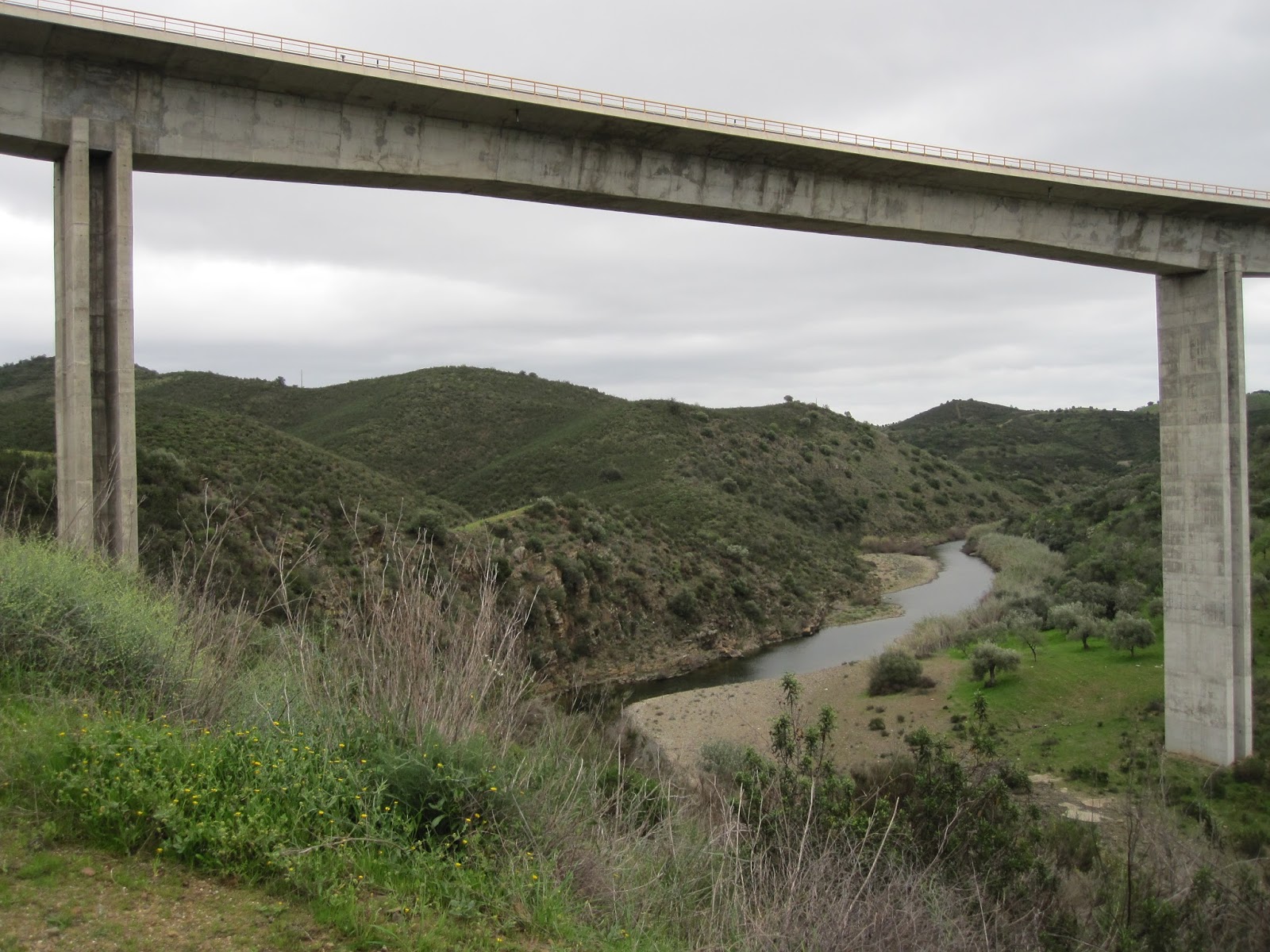
I also investigated the route I had intended to follow tomorrow. I had been hopeful as it was marked as a road rather than a track. Sadly after a kilometre my way was barred by a padlocked gate. On none of my previous walks in Spain have I seen so many padlocks and so much barbed wire. I felt unwelcome as a walker, which is a shame as the landscape is attractive especially at present with flowers coming out and everything green.

Stork and its nest on top of an electricity pylon

The tower at Bartolome de la Torre


Monday 15 February 2016

15 February to Villaneuva de los castillejos

Turns out that there was only one other person in the Youth hostel, an older lady. A shame as the hostel must of had a capacity of a hundred or so young people and was very pleasant by the river and with a swimming pool. Probably busy in the summer. I was glad it was open as the hotel next door certainly was not.
I caught the first ferry of the day to cross the River Guardiana to Spain and the pretty village of Sanlucar de Guardiana. Like Alcoutim opposite it in Portugal it has a castle and lots of white houses but appears a little smaller.
The next section of the walk to Seville is based on the Garmin map of Spain in my gps. I had three options for getting to Seville, go to the south along the coast with its many accommodation options and sea views, go to the north which had more hills and one assumes scenic terrain but appeared to have few places to stay, or go the most direct route across what looked like farmland. I choose the most direct route not wanting to rule out an area without having seen it. I then identified where there were hotels or similar on the line of travel and asked the Garmin gps software to pick a walking route which it does by avoiding main roads as far as possible.
Following this route along dirt tracks worked well for the first 11 km from Sanlucar passing through grassland and scrub and across a small river. A shepherd even offered me a sweet as he watched his sheep. Then after a stretch of road the gps had selected an interesting route through some hills that looked attractive. Sadly the gates to the selected track and similar ones were padlocked and there was a high fence often topped by barbed wire. It was clear I was not welcome in an area that looked like it was being managed for hunting.
So it was 7.7 km along the road to Villaneuva de Los Castillejos (according to the footpath sign directing you along the road), a total of 21.3 km for the day according to the gps.
The Hotel Andalusia where I had planned to stay was not where the gps thought it was but turned up opposite the Petrol station after a bit if wondering around.

The village of Sanlucar de Guardiana

Sunday 14 February 2016

Walking the Via Agarviana (GR13)

This relatively unknown, long distance footpath falls into two parts: west of Alte the towns are bigger and seem more prosperous with a choice of accomodation (bookable on line) and a selection of restaurants. Tourists are commonly sighted. East of Alte villages are small and have empty houses and ruins of houses left  by people moving away, old men with flat caps and old women with hats of a greater variety. Accomodation is limited to a Casa (like a bed & breakfast) in the village at the end of each stage. No doubt the Via Algarviana was routed through this area to bring in some much needed money. I could have wild camped more but it would have felt that I was depriving people of much needed income and purpose.
The dogs in the villages and isolated farmhouses have made it clear I am not welcome, chasing me out of town with their furious barking. Fortunately, the most vicious  ones were behind fences or chained so I was never actually attacked.
Overall it is a good walk to do in the winter months when other paths in Europe are covered with snow or subject to really inclement weather. In summer there are more spectacular, historically interesting and varied long distance footpaths and the Algarve would probably be too hot for walking.

In all I covered 312 kilometres, The way-marking was generally very good, with the standard red and white marking as used in France, and reference to the name and designation of the path (Via Algarviana and GR13). I used my Garmin gps when in doubt, which had a Garmin Portugal Topo Light map which was perfectly adequate and had GR paths marked. I also down-loaded the gpx file from the Via Algarviana website (http://www.viaalgarviana.org/?lang=en) which also helped to remove ambiguity. The official guide did provide background information and details of accommodation and cafes, and the associated maps from the Sagres Tourist office gave a better feel for where I was going. A paper copy is not however essential if you copy down key information from the internet like where you are planning to stay. Much of the accommodation can be booked via booking.com but not the "Casa's" in the last 4 or 5 villages. There is a gap in accommodation at Cachopo, where I camped but this does mean carrying a tent with you and risking any angry land owners. I note that commercial companies, who can book the route for you, include a transfer to another village for the night.


14 February to Alcoutim

The final (or for most people the first) 24.2 kilometre stage of the Via Algarviana forms a big "hook" and the question is whether the extra 10 km or more to do the hook is really worth it. It does take you to two standing stones but although they are important historically they are not that dramatic. Nevertheless the walk is pleasant though more grassland than previous days, sprinkled liberally with daisies, dandelions and some flocks of sheep. It passes through a few villages all with whitewashed walls and red tile roofs  I wonder if there is a regulation to enforce this so that all you can choose is the colour to edge your windows with, yellow ochre being traditional but with some people using blues and pinks. After a miniature coffee and rather larger cake in a little cafe in one village the path eventually reached the River Guardiana. Not quite as impressive as I hoped and rather muddy although a sudden hailstorm did not improve the appearance. There had been sudden showers all day with fresh winds and sunny spells.
Alcoutim is a pretty town with a quayside, castle and various churches. I am staying at the very reasonably priced Youth Hostel having dined in town next to a big gathering of men and football on  the TV, pretty typical, wonder what their wives were doing?

Flower covered grassland

Standing stones

End (of beginning) of the Via Algarviana at Alcoutim

13 February to Balurcos

After a huge breakfast (cheese, ham, curd cheese, honey, jam, oranges, bread & coffee with milk) and being encouraged to eat more, I did a side path (PR9) to a copper mine. The path to the mine was overgrown but I did find a short tunnel but no copper minerals or shaft. Bit of a struggle to find the path back, I had to push through dense vegetation to where the gps said the main path was. I should have recorded my way down on my gps to help me get out again.
The path to Balurcos was similar to the previous day except it crossed and recrossed a main road, going underneath an impressive viaduct. Not much traffic on such a nice, new, high speed road. Almost got wet crossing the river beneath the viaduct as I could not find any of the usual stepping stones.
Staying at Casa de Campo Vale das Hortas, with an evening meal at the bar a kilometre up the road, where everyone was watching the football.
14.3 km today excluding the trip to the mine.


12 February to Furnazinhas

Today the slopes were less steep and the landscape more gentle. The scrub included wild lavender and rosemary and occasional almond trees in flower. There were a number of pine plantations, none of these trees are very tall, the landscape will be quite different in years to come if they reach any size. Near the villages there are sometimes small vineyards presumably for domestic use and little olive groves. I saw the occasional flock of sheep or goats often with an old shepherd and his dog to look after them. One flock had strange straight horns, twisted like Dali's moustache.
The lady last night at Casa D'Aldeia in Vaqueiros kindly volunteered entirely using sign language to reserve a place in the only accommodation in the next place, Furnazinhas, Casa do Lavrador where I am now. The lady here is equally chatty (in Portuguese) but not so good at sign language, so she rang someone who spoke English who asked me what time I wanted dinner etc.. She had also warned the next place on route that I was on my way and would need a bed. News travels fast!
Dinner was huge! Tomatoes with herbs, cheese & olives to start, then a large bowl of chicken stew with potatoes and carrots, and desert of oranges with cinnamon, same as last night. Still I had walked 20.3 km.

Casa do Lavrador

Thursday 11 February 2016

11 February to Vaqueiros

Sounds of birdsong woke me and after decamping I climbed up to the white-washed village of Cachopo. Finding a tiny shop in one of the narrow steets I stocked on water, cheese and chocolate, and apples to be healthy. Then had my morning, minature coffee with a cake. The barman was wearing a flat cap like most of the men in town, although one had a trilby. There is something a bit old fashioned about it all, most of the people were older and somewhat weather beaten.
At least Cachopo was an active community, many of the houses in the next two villages looked abandoned with the odd rather hopeful written sign saying Vende Se, for sale. However there always seems to be one or two barking dogs to make you feel unwelcome. The hills and pine plantations I walked through today were devoid of people although there was the odd patch of well tended olive trees.
I stopped at a cafe at Vaqueiros at about two after some 19.1 kilometres and the landlady mimed sleeping, I took this as an offer of a room for the night and as I had completed two long days I gratefully took up the offer. The suite provided (at Casa D'Aldeia) is very smart (unlike the cafe) with natural soap and fluffy towels.

Vaqueiros

10 February to Cachopo - almost

The path is moving into progressively more remote countryside with lots of hills to climb covered in scrub, some cork and pine trees. Occasionally the pine trees are on plantations. I lunched at Parises. The snack bar looked closed but I peered in through the hanging chains across the door and found the lights on and a man and woman eating a bean stew, the lady wearing a straw hat. I used my phrase book to ask for some food and then said "Si" to whatever the good lady suggested. This turned out to be eggs, tomatoes and pieces of meat the shape and taste of slices of chorizo sausage. Oranges for desert, the first time I was offered them despite seeing them ripe on trees in fields and gardens (although in subsequent days, slices of oranges with cinnamon proved a popular desert). Then doughnut type things with coffee, a much appreciated feast, although a bit heavy for the afternoon's walking.
There being no convenient accommodation I wild camped by a stream after a days walk of 29.7 kilometres. Due to steep slopes, a lot of undergrowth, including brambles that would tear my lightweight tent, finding a suitable camping spot was not easy, especially as I like to be out of sight as far as possible in case anyone did not like my presence. I need not have worried as no one drove along the nearby tracks that night and I slept to the gentle sound of turning wind turbines which smudged the clouds with their red lights. It rained occasionally during the day and rained again that night, awakening me from my sleep, fortunately my tent (a Nordisc telemark) resisted both the rain and intermittent wind (although I was glad I camped in the valley where it was more sheltered).


Tuesday 9 February 2016

9 February to Cortelha

To avoid a short day I combined two of the stages in the official guidebook (or one and two thirds to be precise) stopping at Salir for lunch (chicken stew and potatoes, probably a bit heavy for walking) and stopping for the night at Cortelha (Casa de Campo Cantinho da Serra opposite the petrol station). Some 27.6 km. The first part of the route was through scrub, then coming up to Salir there was more agricultural land with a lot of wells with interesting, but now disused devices to lift the water in particular chains of buckets. There was an information board giving the background. After Salir the limestone changed to an old sandstone and the land became more remote with scrub and cork trees. There were also some good climbs.
The weather was cloudy in the morning and raining intermittently in the afternoon, starting every time I took my waterproofs off.
I may have been a bit harsh on the Portuguese yesterday, today in one of the villages (Benafim) a man spontaneously pointed out the direction to take and another said "bom dia" before I did!
Wild boar stew for dinner, washed down by red wine. The people at the bar asked me where I was from, when I said Wales they recited more members of the Welsh Rugby team than I had ever heard off! Clearly more knowledgeable on international sport than I was.
Old well

Monday 8 February 2016

8 February to Alte

Only 19.3 kilometres today. After taking a somewhat circuitous route to start with, the path followed a valley to Alte. The scenery was pleasant rather than dramatic passing through areas of apparently abandoned farmland, the terraces and stone walls still present together with olive and other trees. The best part was a short section of footpath, as opposed to the road, farm or forestry tracks that the Via Algarviana is usually composed of, which followed some of the old terracing.
The route has now entered a limestone area with numerous wells often with devices for pumping the water out consisting of large blue handwheels or more rarely a chain of buckets passing over a wheel. I passed a couple walking the Via Algarviana in the opposite direction, I was the first walker they had seen in 8 days.
I am noticing the way people stare at me without saying anything, for example in the petrol station coffee shop I stopped at today. The lady behind the counter was helpful but some of the customers possibly thought I was from Mars, maybe they do not see many walkers.
I am staying at the Alte hotel which seems good value, it is a little before Alte so I walked into town, my progress telegraphed by the dogs at each building I passed. It is a pleasant place with cobbled streets and white-washed buildings. The church was open for visitors which is unusual and there were several tourists around possibly from the motorhomes in the car park. While quietly walking back a stern looking old lady said something to me. As it was in Portuguese I did not understand what but felt guilty all the same. Was it because I smiled politely at her?
Meet a British cyclist at dinner (grilled bacalhau) touring the area.

Alte


Sunday 7 February 2016

7 February to Sao Bartolomeu de Messines

Another long day of some 27.6 km and an 1104 m elevation gain. It started well at the Hotel Vila Sodre with an impressive breakfast (two types cheese, ham, two types of bread, curds with jam, two types of little tarts, etc.) served with a smile.
The early part of the walk involved going up and down hills in woods of young eucalyptus or scrub, then there was a lengthy section along a reservoir before the final push over a hill into Bartolomeu de Messines. Being Sunday people were out enjoying themselves. I was passed by a bevy of cyclists in black lycra, a group of dirt bike riders, people out for walk or out fishing.
On arrival at the Bartolomeu Guesthouse I discovered it was carnival time. There were floats pulled by tractors and people dancing behind them dressed as red Indians or something out of Frozen.


Saturday 6 February 2016

6 February to Silves

Today was a tough day, 28.6 km and 956 m elevation gain, but very scenic climbing over Picota, Algarve's second highest mountain. The summit was mainly bare rock like a granite tor although the rock is actually syenite (it contains no quartz). The rock is used in the buildings and cobble stone streets of Monchique and when wet the laths of feldspar show up nicely. The day was cloudy after a misty start which limited long distance visibility and made the colours dull and dusty, although various flowers worked hard to provide some brightness.
After Picota the path drops down and it was here I met my first backpacker walking the Via Algarviana but in the opposite direction to me and complete with guitar. After walking along a brook and managing to cross in a few places without getting wet, the path joined a river, shaded by Mimosa trees with sprays of yellow flowers. The path then climbed through wooded hills. The final part had good views although the wide bulldozed roads (firebreaks?) did detract from the beauty a bit. Whoever planned the route made sure it went over every possible hill so I arrived at my hotel (Residential Vila Sodre) on the outskirts of Silves somewhat tired and too late in the evening to explore the fortifications I could see in the town.
Chicken piri piri tonight at the Cross of Portugal entertained by a British man on the adjacent table telling his relatives (including a little Portuguese grandma) how awful his son was.
Picota

I took this to be a crocus


Friday 5 February 2016

5 February to Monchique

A shorter day today of only14 km so a leisurely start. The first part of the walk involved some steep climbing through eucalyptus then past the ubiquitous wind turbines before levelling out among scrubby brambles, heather and the like. Beneath was a terraced landscape possibly once used for arable crops but now used for grazing cows and sheep among the ruins of old farm buildings.
I diverted up to the top of Foia, the highest point in the Algarve. Sadly low cloud and mist prevented me from seeing the view. On the plus side the snack bar was open and I had coffee and apple cake as their only customer.
From Foia it is a short distance downhill to the pretty town of Monchique with its white washed walls, red tile roofs, narrow cobbled streets, interesting sculptures, a chocolate shop and terraced municipal gardens. I saw a children dressed as toadstools and other things, I had just missed the carnival it seems.
I am staying at the Miradouro da Serra which is a reasonably priced guesthouse with a view of the mountains, if a little dated.
In the evening, having eaten pork three days in a row, I tried the tuna with onions which had appeared on a number of menus. It was a surprisingly good combination.
Terraced hillside

Sculptures in Monchique

Thursday 4 February 2016

4 February to Marmelete

As today's walk was some 40km long I started early when the crescent moon and stars were still visible. I took the road to Bensafrim as the southern sky turned first an iridescent pale blue, then yellow above orange, picked out by scattered clouds.
At Bensafrim I had a breakfast coffee in very much a man's bar with calender's showing bare breasted girls of improbable dimensions, no longer seen in the UK. Half the customers and the landlord were drinking brandy or some clear spirit all before 8 am.
From Bensafrim the path went through farmland with ripe oranges before heading up a valley where the fields gradually turned to scrub. Shotguns sounded nearby but I could not identify the hunters. In France I have seen them with camouflage clothes to blend in with the surroundings and then a bright orange waistcoat so that they are not accidentally shot. I should wear a bright orange hat so they do not accidentally shoot me but I prefer to be discrete and blend in with my surroundings. However it is difficult to pass farmhouses discretely, as you approach, first one and then several dogs start barking. They rush at you no doubt bent on biting my now well-muscled calf, until stopped by a fence or the length of their chain. I exaggerate, while some dogs clearly want to kill me others are waggling their tails while barking madly, probably bored and wanting to join me on my walk.
After crossing a watershed the path dropped down to a reservoir before climbing up another valley. The hills were now becoming mountainous with deeply incised valleys and there was a steep climb out of the valley to the road leading to Marmelete. Marmelete is a pleasant town with a great view to the south. It also has a museum to medronho, a spirit or aguadente made from the strawberry tree. Admission included free samples which no doubt improved my view of the village.
My lodgings at Horta do ze Miguel were a few kilometres further on up more steep slopes, but the reward was pleasant accommodation among trees with ripe lemons and a view to match.


Wednesday 3 February 2016

3 February to Barao de Sao Joao

The day started with a minute but strong coffee and something a bit like a croissant. As in Spain the bar was full of men. The walk today was hilly and after some farmland went through wooded areas with pines, eucalyptus, occasional cork trees and many wind turbines. Another shortish day at 23.6 km.


I spent the night in Barao de Sao Joao (at Casa do Joao). The landlady of the rooms I am staying at was very chatty, unfortunately as it was all in Portuguese I understood very little and just smiled in and nodded in a friendly manner.
There was evidence of an artistic community in the town with several tall, thin statues, paintings on walls and what looked like two rats or cats copulating(?) on a roof by a friendly restaurant and bar.


Tuesday 2 February 2016

2 February to Vila do Bispo

As I prepared to decamp the sunrise was deep red through the pine trees of the campsite. Maybe a shepherd's warning however the day was sunny with a north wind keeping things cool. First I walked to Cabo Sao Vicente where the Via Algarviana and a few other long distance paths start. Cabo S Vicente is the south-west corner of Europe and lacked the commercial enterprises selling soft drinks and souvenirs you might expect. There was a lighthouse and some buildings that you cannot access, cliffs (with a few fishermen precariously fishing off some ledges on them) and a lot of open ocean. As in other places along the coast there were a number of motorhomes no doubt escaping, like me, the inclement weather in Northern Europe.
From the cape the path follows small roads and tracks through flatish landscape often left to grow wild and used for sheep grazing or hunting. Coming from the British winter I was struck by the number of flowers, daisies in densely packed patches, various yellow flowers and others I could not identify. A short day today at 22 km from the campsite.

Road north from Cabo Sao Vicente

I stayed the night at Vila do Bispo, in the Casa Mestre guesthouse. Two other hikers were staying there but they were heading north on the GR11. They were cooking pasta in the communal kitchen but I was keen to try the local cuisine. There were many restaurants in Vila do Bispo, most of them closed. I went in the first one open as their only customer that evening. As I had troubling identifying something on the menu that was actually available I asked for a recommendation. Pigs cheeks were suggested, not on the menu but better than the name suggests served as a casserole and very tender.

1 February to Sagres

Today consisted of travelling. Flight to Faro airport, No 16 bus to Faro, train to Lagos and bus to Sagres where I camped the night at the Orbitur campsite. Thanks to the wonders of the Internet I knew what to catch and when, thankfully everything was reasonably punctual. I even had time to promenade along the river at Lagos and buy an ice cream while watching seagulls circle a boat coming in. At Sages I left the bus at the Tourist information office. I asked about the Via Algarviana and was given a cardboard box about the size and weight of a brick with a book size guide (part of which I had used up a colour cartridge printing at home). To achieve a weight practical for carrying  I threw away the maps for cycle routes and linking paths, the other maps look a useful supplement to my GPS. Fresh (I think) fish for dinner since the restaurant overlooked the sea.

Sunday 31 January 2016

31 January to Bristol Airport

First step on my journey was to Bristol airport where flights radiate out across Europe. My flight to Faro, in the Algarve, leaves early in the morning so I am staying the night at the Forge Guesthouse, within walking distance of the airport. Leaving is always difficult, the excitement is bounded with sadness at leaving loved ones, my joy at starting a new adventure is blended with sorrow at leaving my wife, and her sadness at leaving me for the next five weeks. It makes goodbyes difficult. This goodbye was especially miserable as the rain, darkness and fog encountered when she kindly drove me to the guesthouse made us tense, the satnav selecting a particularly obscure route through country lanes blocked by a too large bus. It must have had the same satnav.

Thursday 21 January 2016

Via Algarviana (GR13) in Portugal as part of E4 cross Europe Trail

Starting in September 2014 following early retirement, I have been walking the E4 cross Europe walk (report on my walk on E4), which is one of the ultra long distance trails created by the European Ramblers Association. The official E4 path starts in Tarifa at the very south of Spain, and the most southern point in mainland Europe, and ends in Cyprus. So far I have walked from Tarifa to Lake Constance in Switzerland in four 5 week sections (the longest I can manage without seeing my wife). However the next section in Austria and Germany is best not walked in winter, at least not for someone of my abilities, so I was looking for somewhere to walk in winter. I noticed that the Via Algarviana footpath in Portugal was pitching to be the new, more westerly start for the E4 (see Via Algarviana website), and this area of the Algarve, the mountains behind the more popular coast, sounded as if it would be very pleasant to walk in February (a lot more pleasant than the Pembrokeshire coast path in January from which I have recently returned and which was very wet and windy, albeit a good way to loose some Christmas fat).

After the Via Algarviana I wanted to link up with the start of the E4 in Tarifa. Due to the lack of places to cross the River Guadalquivir, this means first going from the end of the Via Algarviana at Alcoutim in Portugal to Seville (not that visiting the beautiful city of Seville is any hardship). From Seville my intention is to follow the Way of St James (the Via Augusta section of the Camino de Santiago) in the wrong direction towards Cadiz (see pilgrims route from Cadiz to Seville), and then follow the coast to Tarifa.